Topics:
Introduction:
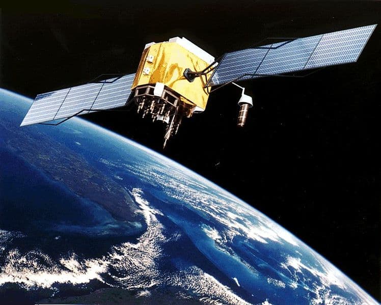
GPS is an abbreviation of Global Positionings System. GPS consists of a network of satellites that orbit around the earth. These continually transmit their position. GPS receivers in navigation devices need 3 to 8 satellites to determine the exact position and (driving) direction on earth to an accuracy of one meter.
Positioning:
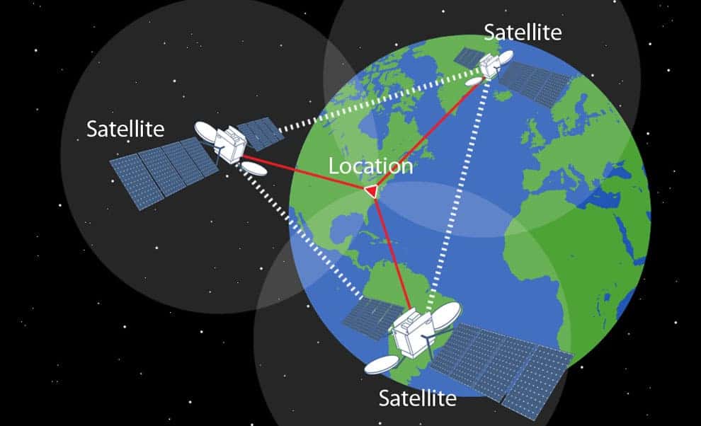
For positioning, 24 satellites are used that orbit the earth at an altitude of approximately 20,000 km. The positions of the satellites are such that at least five satellites have one and the same point on earth within their range at the same time.
With a minimum of three satellites, a three-dimensional space can be calculated if we know the distance between three fixed points. Positioning takes place by calculating the time between sending and receiving the signals. We can calculate the distance between the receiver and each satellite by multiplying the time by the speed of light (300,000 km per second). When we do this with at least three satellites, we can draw imaginary lines to one common point. A fourth satellite increases the accuracy of the positioning.
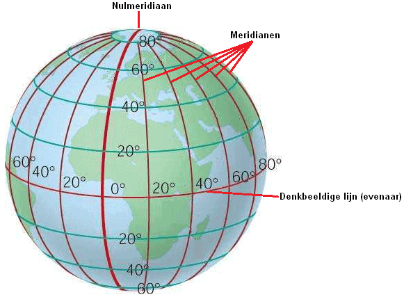
The position is displayed by the receiver in degrees of longitude and latitude. The equator is at 0° and the poles at 90°. The lines of longitude (meridians) connect the poles to each other. Meridians are imaginary lines across the earth:
- perpendicular to the equator;
- from pole to pole.
- max. 60 minutes (‘)
- and a minute into max. 60 seconds (“).
Together with the position in degrees relative to the equator (the latitude) and, if applicable, the altitude, every place on earth can be indicated.
In Amsterdam, the following position is determined by the GPS receiver:
- Number of satellites: 4
- N: 52°22’02.8″
- E: 4°53’48.7″
- S: 28°21’15.5″
- E: 23°53’13.0″
- S: 4°51’56.4″
- W: 51°57’27.7″
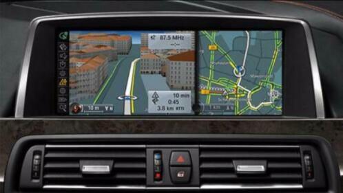
Navigation system:
On land and road maps the lines of longitude and latitude are shown. The geographical location of every place is known. As soon as the GPS receiver in the car knows the current position, it can be compared with the coordinates of the road map.
The driving direction and the distance to the destination are calculated with the help of the satellites and displayed on the screen in the car.
Example: we want to drive from Dordrecht (South Holland) to Paris.
The coordinates are as follows:
- Dordrecht: 51°48’33.2″N 4°38’53.0″E
- Paris: 48°51’16.8″N 2°20’52.0″E
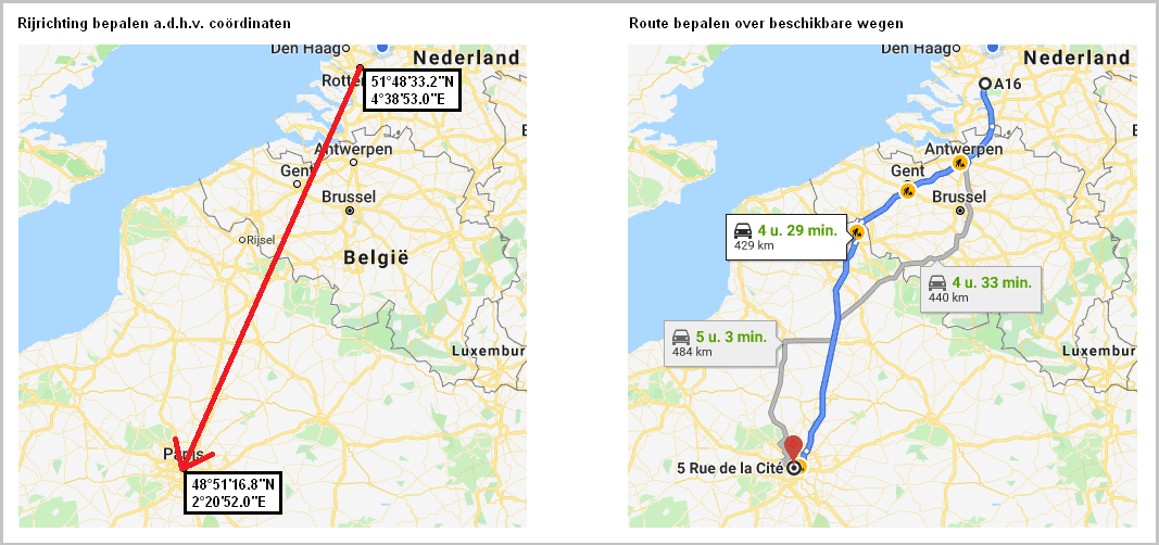
Based on the coordinates, the location of the destination and the distance are calculated. Using the information in the previous paragraph, we can say the following about the coordinates:
- From 51 degrees north to 48 degrees. This is closer to the equator, so the route is heading south;
- From 4 degrees east to 2 degrees: this is closer to the prime meridian, so the route is heading west.
The software in the navigation computer calculates the most logical route on the basis of the road map. It takes into account factors such as unpaved roads, toll roads, ferries, etc. When the system is connected to the internet, the software also takes traffic conditions into account. If it turns out that there is a delay on the most logical (standard) route, an alternative route is offered. This may be a route with a greater distance, but thanks to the favourable traffic situation it can still be a fast route.